Understanding Groundwater Flow in the Yucatán Peninsula
The Yucatán Peninsula is home to one of the most unique and complex groundwater systems in the world. Unlike many regions that rely on surface rivers and lakes, the majority of freshwater in the Yucatán flows beneath the surface through an extensive network of limestone formations, underground rivers, and interconnected cave systems. The Aquifer Mapping 2025 initiative aims to deepen scientific understanding of how these groundwater systems function and how they respond to environmental pressures.
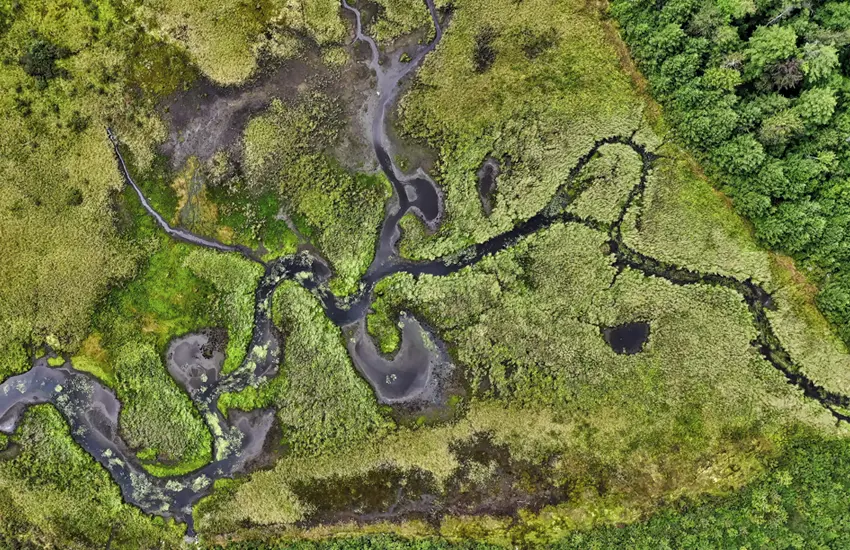
Aquifers in karst regions such as the Yucatán are particularly difficult to map. The porous limestone landscape allows water to move rapidly through underground channels, often creating hidden pathways that are difficult to detect using traditional hydrological methods. For this reason, researchers are using a combination of advanced technologies, including satellite imaging, geophysical surveys, and field-based exploration, to better understand the structure and connectivity of these subsurface water systems.
A major focus of the project is identifying how groundwater flows between cenotes, underground caves, and coastal discharge zones. Cenotes, the natural sinkholes that are characteristic of the Yucatán landscape, act as critical access points to the aquifer. By studying water movement through these openings, scientists can gather valuable data about the direction and speed of groundwater flow.
Mapping the aquifer is also essential for sustainable water management. Millions of people rely on this underground water system for drinking water, agriculture, and tourism-related activities. Without a clear understanding of how water moves through the aquifer, it becomes difficult to protect it from pollution, overuse, or environmental degradation.
The Aquifer Mapping 2025 study represents a significant step toward creating a comprehensive model of groundwater movement throughout the region. The findings will help researchers, policymakers, and environmental organizations make informed decisions about conservation strategies and long-term water security.
Ultimately, the goal of this research is not only to expand scientific knowledge but also to ensure that the fragile freshwater systems of the Yucatán Peninsula remain protected for future generations.
Massa suspendisse lorem turpis ac. Pellentesque volutpat faucibus pellentesque velit in, leo odio molestie, magnis vitae condimentum.
Aute mi ut suspendisse velit leo, vel risus ac. Amet dui dignissim fermentum malesuada auctor volutpat, vestibulum ipsum nulla.
Sed reprehenderit quam, non felis, erat cum a, gravida lorem a. Ultricies in pellentesque ipsum arcu ipsum ridiculus velit magna, ut a elit est. Ultricies metus arcu sed massa. Massa suspendisse lorem turpis ac.
Eu et tellus vestibulum taciti et sit, nunc enim ipsum donec aliquam vitae, per mauris, amet ultrices. Pellentesque amet proin ut vestibulum eleifend nam, wisi vel tellus pulvinar mi risus consectetuer, sed faucibus facilisi, accumsan nam.